
Single Mom Housing: Practical Strategies For Navigating The Rental Market
Choosing neighborhoods and assessing safety, schools, and services
Neighborhood selection typically balances affordability, proximity to work or school, public transportation access, and availability of services such as healthcare and childcare. Assessing these factors may involve reviewing local transit maps, school information from public sources, and walkability scores where available. Safety perceptions and objective measures like local crime statistics can inform choices, though such data often requires contextual interpretation; consulting multiple sources and visiting neighborhoods at different times can provide a more complete perspective.
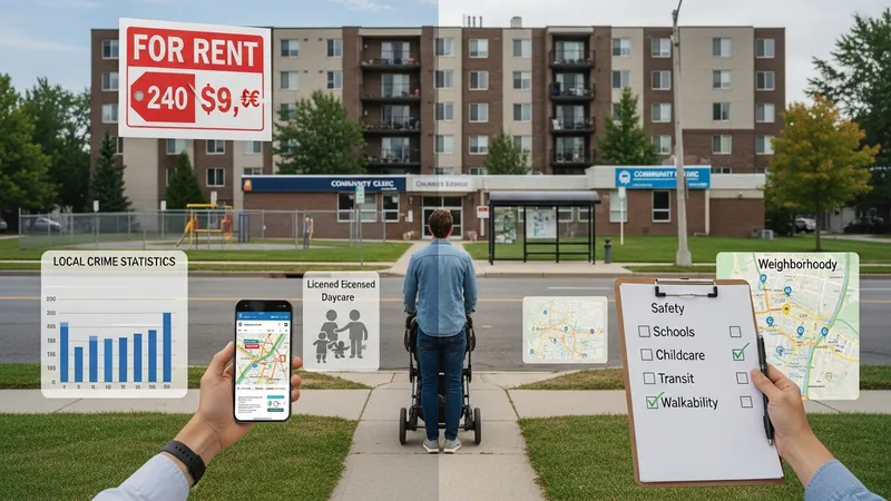
Access to childcare and schools is frequently a decisive factor for single parents. Typical considerations include commute times, enrollment capacity, and whether after-school care is available near home or near a workplace. School district resources and program offerings may be found through official district websites or local education authorities. Families often weigh the convenience of proximity against rental cost differences to determine how these trade-offs impact daily routines and total household expense.
Transportation needs can significantly influence housing affordability and daily logistics. A unit that reduces commuting time may lower childcare costs or allow for more flexible work arrangements. Conversely, rentals in lower-rent areas with limited transit coverage can increase reliance on private vehicles and associated costs. Estimating typical commute times and available transit options is a practical step when comparing neighborhoods in terms of overall livability and cost.
Local services and community supports, such as food banks, health clinics, and family resource centers, may be relevant for households managing tight budgets. Mapping these resources in relation to potential housing can inform choices about daily accessibility. While such services are not a substitute for secure housing, they commonly form part of the ecosystem that supports household stability and can reduce logistical friction in day-to-day life.